
Discover 150+
Staffordshire Walks.


Download the app and explore the best Staffordshire walks.

Our walking app provides easy to follow routes, showing your position on the map as you walk. It uses your phone GPS to guide you and gives you the confidence to explore and enjoy new walks in Staffordshire. So, if you are looking for your next Staffordshire walking adventure, download the app, choose a walk and just follow the pointer.
Get the iPhone version here or Android version here.
It’s like sat-nav… but for footpaths.
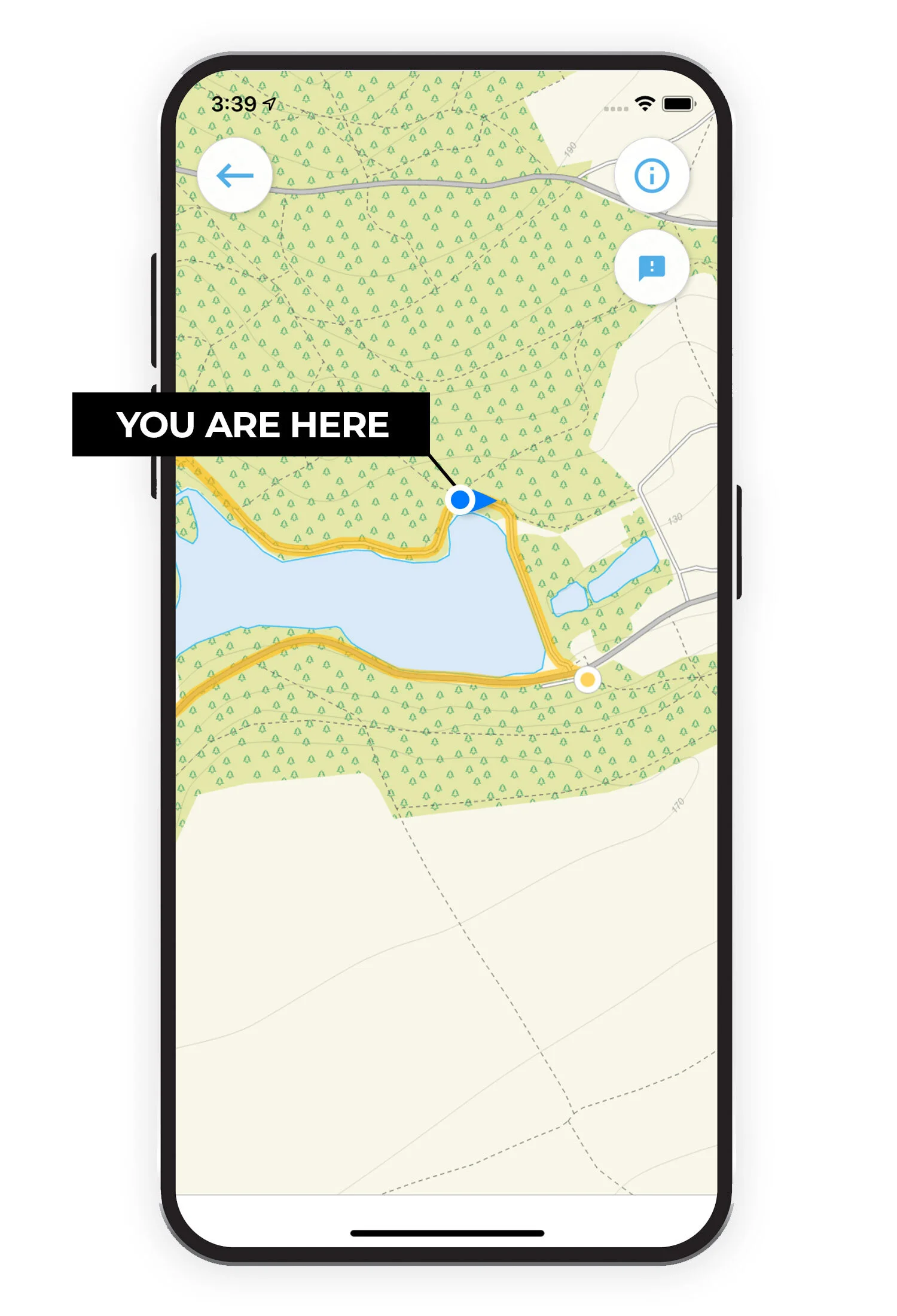
See your position on the route map as you walk.
Our mobile walking guide app includes 150 walks in and around Staffordshire. Download Staffordshire Walks now on the iTunes or Google Play app store.

Join our community.
facebook.com/walks.staffordshire
Like us on Facebook and join the 1,000’s of people who recommend, discover, feedback and enjoy new walks in Staffordshire.
We love discovering new walks in Staffordshire and our growing community help us find the best walks so that we can research and share them in the app. Our users can rate each walk based on a number of factors such as how dog or buggy friendly it is, pub on route etc, so that you can find your perfect walks.
If you want to join our community, just head over to facebook.com/walks.staffordshire and get involved!


Here is a list of Staffordshire Walks we have on the app so far…
Abbots Bromley
2.75 miles
This first route is a pleasant and simple stroll around the pretty village of Abbots Bromley and the open farmland immediately surrounding the village. There are some quiet country lane sections of walking on this route and there also are a number of nice pubs in the village for refreshments after or before your walk.
Abbots Bromley
3 miles
The second route is very similar to the first route in terms of distance and the scenery that you'll experience. However, this route heads straight out of the village and it then takes you on a loop through more open farmland to the south. You'll enjoy more peaceful countryside here than you would on the first route, but there is an 800m section walking along a quiet country lane at the bottom of the loop to be aware of.
Abbots Bromley
3.5 miles
This fourth route option is again very similar to the first two routes in that enjoys the pretty village and then a loop of walking that takes you out into the peaceful open farmland surrounding the village. This route is a bit longer and heads northeast out of the village, so there's something different for you if you've tried the other routes, but be aware that there is a 800m section of walking along a quiet country lane on this option, so please be aware and careful on this section.
Abbots Bromley
9 miles
This final route is basically a very long walk that combines all of the other routes together to create an epic adventure of exploration around the village of Abbots Bromley and it's surrounding countryside. As with some of the other routes, there are some sections of walking along quiet country lanes, so please be careful on these sections of this walk. Additionally, as with all long walks on the app, please ensure you have fully charged your phone before you set off and only use the app when you really need to navigate (as looking at the route map constantly uses more GPS battery). Ideally, take alternative navigation with you on the longer walks.
Alton
2.75 miles
This first option is a short circular loop starts at Alton Village hall car park and takes you into Alton village and then out to open fields and farmland. The walk crosses the river Churnet and proceeds on to the Old Railway line which is now a pretty track, after crossing the River Churnet again and passing through Crump Wood, the route takes you back over the river and fields towards Alton. There are pubs and refreshments in Alton.
Alton
3.5 miles
This second option is a pretty circular loop starts at Alton Village hall car park and takes you into Alton village and then out to open fields and farmland. The walk crosses the river Churnet and proceeds on to the Old Railway line and takes you towards Crumpwood Weir. The walk continues along the hedge lined track heading towards Alverton Hall before taking you back along the ancient Salterford Lane to Alton. There is a small amount of road walking through the village but most of the walk is countryside. There are pubs and refreshments in Alton.
Alton
5.25 miles
Our final option from Alton is a scenic circular walk that starts at Alton Village Hall car park and takes you through the village of Alton onto the open fields, farmland and meadows that cross the River Churnet. The walk takes you to Crumpwood Weir and along the lanes and fields until you reach the B5032. This is a fairly busy road and you do have to walk along it without footpaths to join up with the Staffordshire Way footpath after the Old Railway bridge. This leads you to Saltersford Lane which is an ancient trackway. Follow this pretty track back to the start of the walk at Alton. There are some moderate gradients during the walk but plenty of pubs and refreshments in Alton.
Apedale Country Park
1.25 miles
Apedale Country Park is a lovely 454 acre country park near Newcastle-under-Lyme. The park used to be an opencast mine and has been turned into a varied landscape of woodland and meadows. This first walk is a short family-friendly stroll around the park where you can explore the network of paths, enjoy the abundance of wildlife and visit the Apedale Winding Wheel. The paths are a reasonably solid mixture of gravel and tarmac and the route is a bit hilly in places.
Apedale Country Park
2.25 miles
Apedale is the newest country park is Staffordshire and provides a habitat for a wide variety of wildlife. This second route option is basically an extension of the first route and it explores more of the park for those of you that have a bit more time. As with the first route, it's a little bit hilly at times and the paths are a mixture of tarmac and compressed gravel.
Ashton Marina
4.25 miles
This is a lovely walk from Aston Marina which has a great restaurant and bar to enjoy before or after your walk. The route takes you past the pretty marina to the Trent and Mersey Canal where you can wander alongside the waterway, enjoying the views of the water and open countryside. When you reach Upper Burston Bridge you have two choices. You can follow the route to Burston along the lane to a pub (0.8km each way) or keep to the route home which takes you through open fields and wetlands, a great place to see lots of wildlife and then over the River Trent back to the start. You will also pass Aston hall, a magnificent seventeenth century red brick mansion. There is some road walking on quiet lanes and refreshments are available at Aston Marina as well as the pub on route if you choose.
Baggeridge Park
0.5 miles
This first route option is a very short walk around the pretty Baggeridge Park that is situated on the site of the old Baggeridge colliery. This first option is designated on the park as an 'Easy Access' trail which means it was designed with solid and flat paths in mind, making it perfect for wheels.
Baggeridge Park
1.5 miles
This second route is called the 'Baggeridge Circular Route' on the park and it offers a nice variety of the park's pretty woods and meadows as well as a visit to the Bag Pool pond. There is a cafe on the site by the car park.
Baggeridge Park
1.75 miles
This third route option is basically an extension to the second route 'Baggeridge Circular Walk' that still enjoys the woodland and meadows of the park, but it then also takes you on a climb to the 'toposcope' which is the summit of a hill in the park where you can be rewarded with some lovely views.
Baggeridge Park
2.5 miles
The fourth option is a longer adventure in and around the Baggeridge Park. It still enjoys the woodland, meadows, pond and views around the park that you'll experience in the third route, but this option gets a bit more 'wild' as it also heads out of the park into some open countryside and for a long walk through Baggeridge Wood.
Baggeridge Park
6.75 miles
This final walk is the longest route from Baggeridge Park and as well as enjoying a walk through the park itself (as with the other routes), it then takes you on a varied adventure out into the surrounding countryside. You will visit the lovely Himley Park and take a long sweeping stroll along the South Staffordshire railway walk through Himley. You will also pass by the magnificent Himley Hall and enjoy some of it's 180 acres of parkland. Finally, you'll enjoy some open fields and the pretty Wom Brook near Wombourne. There is a short section of road walking alongside a busy road (with a footpath) and you do also have to cross the busy A449 road at one point, so please be very careful here. Apart from that though, the scenery during the rest of the walk is more than worth it. Finally, there is a little detour along the road in Himley that takes you to a choice of two pubs if you want to make this a pub walk day out.
Barton Marina
1.5 miles
Barton Marina is a home for over 300 narrowboats and is linked to the Trent and Mersey Canal. The walk here is a short leisurely wander around the marina and it's network of paths that take you around the lakes and woodland. The marina also offers a range of shops and restaurants.
Barton Marina
8 miles
The second route option from Barton marina is a much longer walk known as 'The Silver Circuit'. It's a long walk provided to us by the National Forest (www.nationalforest.org) and it was created to celebrate 25 years since trees were first planted in the National Forest. This lovely varied walk passes through Needwood Forest and down into the Trent Valley. It was designed to create a loop from the National Forest Way, which it follows between Tatenhill and the Trent & Mersey Canal.
Beacon Park
2.25 miles
This simple leisurely walk takes you around Beacon park, past sloppy wood and Pipe Green and back past the lake. The park itself is set in more than 70 acres with lovely gardens and is close to the centre of Lichfield. The park offers a range of other activities including a children's play area, crazy golf and a lot more. It also has a cafe/bistro for refreshments but please check for opening times. Beacon Park is steeped in history and information boards around the site give you a glimpse into the area's historical past. Please note that there is a small amount of walking along a quiet lane on the route, and you also need to cross a busy road twice, so please be careful at these points.
Blithfield Reservoir
Walks of between 1.25 miles and 3.5 miles.
Branston Water Park
1.5 miles and 1.75 miles
Brewood
3.5 miles
This first route is a lovely varied pub walk that enjoys some peaceful open countryside, a stretch of walking alongside the pretty Shropshire Union canal and then has a loop that takes you into the pretty market town of Brewood where you'll find a lovely church and some nice pubs.
Brewood
4.5 miles
This second walk option heads in the opposite direction to the first route and if you head clockwise, it takes you across woodland to the Shropshire Union Canal towpath. You will then follow the scenic towpath all the way down to Lower Hattons Bridge, after which you will loop all the way back to the start point through peaceful open countryside. There is a very short section of walking along a busy road on the that part of the route to tackle, but there is a big verge to walk on safely.
Brewood
7.25 miles
The final route option is basically a combination of the first two routes put together to create a lovely long and varied walk that enjoys a long stretch of the wonderful canal, some peaceful open countyside and a visit to the market town of Brewood. As with the other routes, there are some short road sections to navigate, so please be careful here.
Brocton
1.25 miles
This first walk is a lovely short family-friendly stroll around the beautiful undulating heathland you'll find around this area of the Cannock Chase. It's a short walk, but it is quite hilly, so go prepared with some energy for the walk.
Brocton
2.75 miles
This second walk option is a lovely varied circular walk starting from the Brocton Coppice car park which takes you down into Sherbrook Valley woodland. As you wander beside the pretty Sher Brook, you can enjoy the wonderful stream, stepping stones and natural surroundings before climbing back up Coppice hill with it's pretty heathland and back to the car park.
Brocton
5.25 miles
This final route is a longer, more varied and more strenuous version of the second walk option. Instead of following the brook around when you are in Sherbrook Valley woodland, you cross the stepping stones and then climb back up the other side and over into Abraham's Valley where you will enjoy more open countryside and woodland paths before crossing back over the brook and up through Coppice Hill to the car park.
Cannock Chase
2.75 miles
Cannock Chase is an Area of Outstanding Natural Beauty in the heart of Staffordshire, packed with woodland walks, wonderful wildlife and glorious walks for all abilities. This first walk is an easy circular route that starts at the visitor centre and takes you through the forest and around Fairoak Pools which are small lakes in the middle of the woods.
Cannock Chase
4.75 miles
This is a longer circular walk that also starts from the Cannock Chase visitor centre. The route heads north west towards Sherbrook Valley and includes woodland paths, hills and a wander beside a pretty brook.
Cannock Chase
8.75 miles
This is our longest Cannock Chase walk and it's an epic trek with a bit of everything. It includes woodland, lakes, wildlife, hills, roads and lots of glorious Staffordshire countryside to enjoy. It's a long and strenuous hike so please go prepared with the appropriate clothing and refreshments.
Castle Ring
0.5 miles
Castle Ring is an ancient monument which is over 2,000 years old and one of at least seven hill forts in Staffordshire. It's a Green Flag Heritage Award winning site and the highest point on Cannock Chase at 240m above sea level. It's also home to an abundance of wildlife. Although it's a very short walk, it's worth the visit and there is a longer walk available to explore from here.
Castle Ring
3.75 miles
If you decide that you want more than just a walk around the ancient Castle Ring, this is a longer and more energetic walk that still enjoys the castle site, but also takes you deep into the forest, strolls past streams and lakes and climbs up hills for some good exercise.
Chasewater Park
3 miles
This walk takes you around Chasewater Country Park where you can follow nature trails around the beautiful lake and through the woodland. You can try one of the many watersports on offer here if you choose. There is a cafe near the start of the walk for refreshments.
Croxden Abbey
2.5 miles
This first walk is a pretty family-friendly countryside stroll that starts outside the 12th century Croxden Abbey which used to be the home to Cistercian monks. If you walk clockwise, the route takes you across fields and climbs through the Staffordshire countryside until you reach the village of Hollington. There is then a small amount of road walking through the village before you walk though more open countryside and then eventually reach a small detour to a great pub with lovely views from the beer garden.
Croxden Abbey
7.25 miles
This second route option is an epic adventure in the undulating countryside around Croxten Abbey. If you head anticlockwise, you'll enjoy a long and hilly walk with lots of peace and quiet as you walk through open farmland with lots of lovely views from the peaks of this hilly landscape. There is a section where you walk through a small golf course, so please be careful here and look out for flying balls! There is also a little detour to a lovely pub towards the end of the walk where you can enjoy a beer garden with great views.
Danebridge
2.75 miles
This first walk is the shortest of three circular walks from this location and starts close to the lovely pub in Wincle. There is limited roadside parking in the village, but the pub also has parking if you pop in and ask permission. You will follow the pretty lane downhill, away from the pub until you see the footpath sign. This walk then takes you across fields until you reach the track that goes past the Danebridge Fisheries, where you can stop and feed the fish! The route continues across fields and woodland, following the shape of the River Dane until you head away from the river across open countryside with some beautiful views before returning to the start.
Danebridge
3.75 miles
This second route is basically an extension to the first route if you have more time and want to stretch your legs a bit more! It'll still enjoy the same beautiful countryside as the first route, but it also takes you on a much longer walk along the Dane Valley Way and alongside the river Dane.
Danebridge
4.75 miles
This final route heads in the opposite direction to the other two routes, and if you head clockwise it will take you along tracks that follow the River Dane, through woodland and pretty open countryside. It then leads you back and over the Back Forest Ridge where you can visit Luds Church, a deep rock cleft and the hanging stone which are layers of rock overhanging the hill. This is a strenuous walk with lots of climbing, but you will be rewarded with some impressive views across Staffordshire and you'll certainly work up a healthy appetite for your reward at the pub at the end of the walk.
Dartmouth Park
0.5 miles
This first route is a really simple walk around the pretty lake at Dartmouth Park. The paths are all tarmac, so it's a perfect short route for wheelchairs and buggies.
Dartmouth Park
1.75 miles
The second route option is a longer walk that explores the whole of Dartmouth Park. You'll stroll around the lakes, visit the sensory garden and war memorial, walk past the play area where the little ones can have some play time and there's even a little optional detour out of the park to a pub if you need refreshments. The paths around the park are all tarmac, so it's suitable for wheelchairs and buggies.
Dimmingsdale Valley
1.25 miles
A lovely short but energetic walk starting from Dimmingsdale car park. This picturesque route will take you past Mill Pond, along woodland paths and you can enjoy a nice hill climb. The route may be muddy at times.
Dimmingsdale Valley
2 miles
This second walk is longer circular route that continues though the magical wooded valley, past lakes and pretty streams. Be prepared for some hill climbing on this route and at times it can be muddy.
Dimmingsdale Valley
3.25 miles
This is an extended version of the second walk where you continue further along the valley, following the stream and walking through Dimmingsdale Wood. This is a strenuous walk that will reward you with beautiful natural surroundings, great views and fresh air in your lungs. This walk may get muddy at times so be prepared and there is a section of walking along a quiet country lane, so please be careful.
Dimmingdale Valley
4.25 miles
This is our longest walk from Dimmingsdale car park which will allow you to enjoy much of the beauty of the shorter walks but also includes walking along leafy country lanes and the River Churnet. If you want an energetic trek with woodland paths and hills, this is the walk for you. Please note that there is a long stretch of this walk that takes you along a quiet country lane. Please be careful on this section.
Dovedale
0.75 miles
This first route option is a simple stroll up and down either side of the wonderful River Dove, with a little stepping stone bridge to enjoy half way around. This option is for those of you that don't have too much time but still want to enjoy the wonderful scenery that this site offers. Heading from the car park, the left side of the river is flat hard surface and suitable for wheels, but the other side on the way back is too bumpy, so if you have a wheelchair or buggy, take the path on the left side of the river there and back instead.
Dovedale
1.25 miles
In stark contrast to the first casual route option, this second short walk option is for the adventurous amongst you! It is basically a very steep climb up to the ridge of the Thorpe Cloud, which actually requires a bit of scrambling at the top, and it rewards you with some breathtaking panoramic views of the entire area. Please be very careful on all aspects of this route as there are dangerous drops, and make sure you have the appropriate clothing and good weather conditions when you go up.
Dovedale
3 miles
This third beautiful walk is an alternative to the main and popular Dove Dale routes, but it's still a wonderful adventure in this lovely area. If you head clockwise, the walk heads along the main River Dove initially, where you can enjoy the river and then cross the picturesque stepping stones. Then, instead of heading deeeper into the Dove Dale, it continues around the base of the majestic Thorpe Cloud hill and then through countryside onto the village of Thorpe. The walk consists of woodland, open fields and the scenic River Dove. There is a little section of road walking on a quiet lane, some mild hills to climb at times, and the option of refreshments at the cafe near the start.
Dovedale
4.25 miles
This fourth route option is a beautiful but very strenuous and adventurous walk that heads a lot deeper into the Dove Dale valley. If you head clockwise, you'll first enjoy a long walk through lovely countryside and around the base of Bunster Hill. There is an optional shortcut marked on the map where you can scramble over the top of this hill, but this isn't for the faint hearted! You don't get off scott free though as eventually, you'll start climbing a very steep hill anyway and then after a while you'll cut into the woods and descend a very steep woodland path until you reach the iconic Ilam's Rock and then head back to the start along the picturesque River Dove Path.
Dovedale
6.25 miles
This fifth option is basically the glory walk of Dove Dale valley and takes you all the way along the river and through the majestic valley until you reach the little village of Milldale. After a little explore of the village, you'll then head back on the other side of the river, joining up with the path you used on the way there after a while. There will be plenty of photo opportunities as you walk within this beautiful scenery and you'll visit the Dove Holes, the intriguing Ilam Rock, Lovers Leap and the iconic stepping stones as you go.
Dovedale
7.25 miles
This final route is the equivalent of going off-piste on your favourite ski resort! If you head clockwise, the first half of the walk takes you along the beautiful, but well-trodden River Dove path through the valley as in the fifth route. However, once you've reached the village of Milldale, the return leg of the walk then heads off the main track into the majestic open access hills to the east of Dove Dale. You'll enjoy wonderful views all along this route, but please be careful on the hills and make sure you go prepared with the appropriate clothing and refreshments.
Downs Banks
1.25 miles
A short circular walk around the National Trust's Downs Bank. Wander through a little wilderness of woodland and heathland and a climb up the hill to be rewarded with wonderful views across the surrounding countryside.
Downs Banks
2.25 miles
This is a slightly longer walk that takes you around the edges of Downs Bank and up the hill for panoramic views across the Staffordshire countryside.
Edgbaston Reservoir
1.75 miles
This is a simple stroll around the perimeter of the Edgbaston Reservoir. The reservoir covers a 70 acre site and is home to a variety of wildlife including birds, newts and bats. The path is solid hard surface throughout, so it's suitable for wheelchairs and buggies.
Flash
3.75 miles
This first walk is a wonderful but strenuous adventure in the Staffordshire Moors that explores some beautiful scenery in the area and visits the Three Shires Head bridge which offers a perfect photo opportunity.
Flash
6 miles
This second walk option is basically an extension of the first route that heads further north from Three Shires Head and explores more of the beautiful Staffordshire Moors.
Forge Mill
1.75 miles
This is a lovely circular walk around the Forge Mill Lake and Nature Reserve. You can expect lots of wildlife on this walk and there are also solid paths throughout so it's a perfect walk for buggies and wheelchairs.
Fradley Junction
4.5 miles
If you fancy a lovely stroll along the canal then this walk is for you. Not one but two separate canals to wander along and there is also a nice pub and cafe beside the canal for well deserved refreshments after your walk. You start the walk at Fradley Junction, which is where the Trent and Mersey and Coventry canals meet. On this route you will also walk through open countryside and Fradley village, please note that there is some road walking on this route.
Hanbury
1.75 miles
This first option is a short circular walk that takes you past the Fault Crater Monument. On this walk, you can actually see the fascinating crater that was created when an underground store for highly explosive bombs exploded in 1944 causing a farm to be obliterated, a reservoir to be completely destroyed and around seventy people to lose their lives. The walk first takes you through fields and then turns in to walk along the edge of the crater (do not try to venture into the crater itself, as there are warnings of potential unexploded bombs!). It then loops back to the beginning of the walk through more open farmland. The pub at the start of the walk offers parking for customers, so if you park here please pop in for some refreshments after or before your walk.
Hanbury
2.75 miles
This second option is a pretty walking loop that takes you in the opposite direction to the first walk, strolling through the village of Hanbury itself and then onto towards the village of Draycott in the Clay via pretty countryside. If you head anticlockwise, you will pass the beautiful church of St Werburgh and cross open fields with scenic views. There is then a stretch of walking along a quiet country lane before the return route then takes you through some meadows and over a stream, passing Greaves Wood which is part of the Needwood Forest. The pub at the start of the walk offers parking for customers, so if you park here please pop in for some refreshments after or before your walk.
Hanbury
5.75 miles
This final route option takes you over fields towards Browns Coppice. From here you can take a little detour to see the Fauld Crater explained above in walk 1. (Do not enter the danger zone!) Once you have completed the crater detour, the route then continues onwards taking you through Queens Purse Wood and across fields towards Tutbury. There is a short stretch of road here on Fauld lane which you need to walk along before meeting up with the route which proceeds over fields, skirting the River Dove and the remains of Tutbury castle before heading back across scenic open countryside. The pub at the start of the walk offers parking for customers, so if you park here please pop in for some refreshments after or before your walk.
Hanchurch Hills
2 miles
This first route option is a nice and simple circular walk that takes you through the Hanchurch Wood Plantation and along quiet country lanes surrounded by pretty open countryside. Some of these woods are made up of commercial conifer plantations and this offers you a peaceful and pretty woodland walk.
Hanchurch Hills
2.5 miles
This second walk option is a lovely route that heads in a different direction to the first walk. This one instead takes you around the peaceful woodlands of Harley Thorn where you can climb to higher ground and take in some panoramic views of the rolling pastures and arable fields.
Hanchurch Hills
3.5 miles
This third route option is basically an extension of the first route and if you head clockwise, it takes you through the Hanchurch Wood Plantation and along quiet country lanes surrounded by lovely open countryside. The extension then takes you past the Hanchurch pools where you can see marsh marigold and watercress growing and often you can see wild deer along this route. Please note that there is a significant section of walking along a quiet country lane on this route, so please be careful here. There is also short and steep climb towards the end of the route as you head back up through the woods to the start.
Hanchurch Hills
6 miles
This fourth route option is basically a figure of eight walk that combines the second and third together to create one long walk in this area of lovely peaceful woodland and countryside. As with the third route, there is a long section of walking along a quiet country lane on this walk, so please be careful here. There is also a steep and short climb back up the woods at one point if you are walking clockwise.
Hanchurch Hills
7.5 miles
The final route option on offer is basically a very long extension to the second route. So you still enjoy the woodland and views of the Harley Thorns woodland, but after that you head out on an epic adventure on public footpaths through mainly open farmland until you reach the village of Swynnerton. The main bonus from this extension is it adds a lovely country pub to the route in Swynnerton and you'll certainly work up an appetite with the extra distance walked. Please note, there is some quiet country lane walking on this route.
Hanley Park
1.5 miles
A nice family friendly stroll around Hanley Park which is in the heart of Stoke-on-Trent. It's a short and easy walk that takes past playgrounds and the pavillion, over the canal and around the lake. It's also on solid paths throughout, so it's a suitable walk for buggies and wheelchairs.
Highgate Common
2 miles
Highgate Common Nature Reserve is owned by the Wildlife Trust and is an ancient lowland heath with a network of paths crossing the woodland and heathland. In late summer, you can see lovely purple flowering heather and the reserve is home to some of the UK's rarest bees and wasps. Please note that the paths can be muddy or uneven in places.
Hixon
4 miles
This first route from the village of Hixon is not the prettiest of walks, but it is one that is interesting if you are into military history. The walk basically takes you out of the village to the north and then on a loop around an old disused RAF airfield. The station, with it's now derelict runways, was operational in 1942 and sent many Wellington Bombers on night raids during the second world war. There is a nice pub opposite the car park for refreshments after your historical journey.
Hixon
4.5 miles
The second route is the prettier walk option from this location and it takes you out on a varied walking adventure in the countryside to the South of the village of Hixon. If you head clockwise it first takes you on a long and steadily uphill walk along a quiet county road called 'Egg Lane' that eventually develops into some rewarding views as you walk. You then loop around and stroll through some more lovely open countryside before eventually reaching the Trent & Mersey Canal for a bit of peaceful canalside walking before heading back along the roadside path back into the village. You do have to cross a busy road a couple of times on the route so please be careful here, and there is a pub opposite the car park for refreshments after your walk.
Hollinsclough
1.25 miles
This first route is a short but strenuous walk from the wonderful village of Hollinsclough. The glory walks are the longer route options we have on the app, but if you just want a short stroll with lovely views and some challenging hills for your exercise, then this option may be for you.
Hollinsclough
1.5 miles
This second route option is another short stroll from Hollinsclough, but this one heads east from the village. This option is the best choice for you if you do want to explore the wonderful landscapes around Hollinsclough, but don't actually want to tackle any of the very steep hills as the walk stays relatively flat.
Hollinsclough
4 miles
From here on in, the walks here get serious and this third option is our shortest route that takes you over the top of the majestic Chrome Hill. The climb to the top of the hill itself is quite a tough one, but you'll be rewarded with some wonderful views as you walk along the ridge. It doesn't stop there either with lots of ascents and descents as you walk around this wonderful loop. As with all significant hill walks, please ensure you have suitable clothing and refreshments for this adventure and always use your common sense when following the trails as phone GPS can sometimes be inaccurate.
Hollinsclough
4.5 miles
This fourth option is basically a simple extension to the third route option that still enjoys the majestic Chrome Hill and the outstanding scenery around the village. The main reason to select this route over the third route, is if you have a little bit more time. As with the third route, it is a strenuous walk over big and steep hills, so please ensure you have suitable clothing and refreshments for this adventure. Additionally, always use your common sense when following the trails as phone GPS can sometimes be inaccurate.
Hollinsclough
6.25 miles
This final route option is the one for you if you want a truly epic (and very strenuous) adventure in this wonderful part of Staffordshire. It of course contains the majestic climb over Chrome Hill, as this is one of the main reasons to walk here, but this route extends the loop even further to enjoy even more of this wonderful countryside. This walk is extremely hilly and strenuous, so please go prepared with suitable clothing and refreshments and especially when up in the hills, use your common sense when following paths as phone's GPS can sometimes be inaccurate.
Hulme End
2.5 miles
Hulme End is a small hamlet in Staffordshire that gives you easy access to the beautiful Manifold valley. This first walk follows the route of the Manifold River along the valley and loops back through the countryside and along pretty lanes. As this is a hilly area, please be prepared, you will need lots of energy and there are some steep inclines. There is also a diversion at the start/end that takes you past a tea room and to a pub.
Hulme End
3.75 miles
The second walk from Hulme End is an extension of the first for those who want to explore the Manifold Valley further. This route also follows the Manifold Way and takes you up and around the back of Ecton Hill and back along country lanes and through the scenic countryside. Like the first walk, please be prepared, there are some steep inclines. There is also a diversion at the start/end that takes you past a tea room and to a pub.
Hulme End
5.5 miles
The third route is a wonderful energetic walk and epic adventure. This route follows the scenic Manifold Way and takes you further along the river until you reach Wetton Mill which is owned by the National Trust and has a tea room if you fancy a half way break. This walk will reward you with beautiful valley scenery but be prepared, it has some steep inclines. There is also some walking along country lanes and a pub is located at the end for well earned refreshments.
Kinver Edge
1.25 miles
This first route is a lovely circular adventure that takes you through pretty woodland near Kinver Edge. As mainly well trodden tracks, these heathland trails allow to meander through the woods enjoying its abundance of wildlife. There are also some steep hills to climb at times on this route, but you'll be rewarded with a wonderful viewpoint for your efforts.
Kinver Edge
2.5 miles
The second walk at Kinver Edge takes you further into the woods so that you can explore more of this wonderful natural environment and habitat for wildlife. The route continues until you reach Nanny's Rock and then brings you back through the woods, past the iron age hill fort and back to the start. As with the first route, there are some very steep inclines on this walk, but the viewpoint is well worth the effort.
Kinver Edge
3.75 miles
This final route option is a further extension again on the first two routes. It still of course enjoys the breathtaking viewpoint from the other routes, but it then takes you much deeper again into the Kingswood Forest Park. As with the other routes from here, there are some steep hills to climb and descend on this walk, so please go prepared with the energy you need for the workout and of course the appropriate clothing.
Leek
0.5 miles
This first route is a short and simple family-friendly stroll around one side of the Ladderedge country park. There's a bit of climbing on this route as you walk around the park, but you are rewarded with a nice viewpoint half way around the walk.
Leek
1.5 miles
This second route is basically an extended version of the first route that still enjoys the climb and lovely views from one side of Ladderedge park. To extend the walk however, it then crosses the road to then explore the other side of the park on a pretty path that tracks the River Churnet and crosses the Barnfield Canal Aqueduct.
Leek
3.5 miles
This third and longer route option is a wonderful varied walk in the countryside to the south of Leek. You'll explore the Ladderedge Country Park as in the first two routes, but then you'll head of on an epic waterside walk alongside the winding Caldon canal. There is also a section of nice woodland walking and some open countryside to enjoy on this route.
Leek
5.25 miles
This fourth route is an extended version of the third route that basically adds a lovely water-side walking loop to the walk and that extra loop takes you to a wonderful canal-side pub for refreshments half way around the overall walk. There is a short roadside walking section on this additional loop, so please be careful here.
Leek
9.5 miles
This final route is an epic adventure that actually walks you in a complete loop around the outside of the town of Leek. If you head clockwise this walk takes you along the Longsdon Walk path first before then turning and walking through more lovely open countryside until you reach a great pub in Abbey Green. After this you then embark into more countryside and climb over a big hill for some nice views before then turning onto a track and heading back towards Leek. As you come into the town there is then a long section of road walking until you then get back into countryside and climb Lowe Hill. After enjoying more great views there, you'll descend the hill, walk past the large town Cemetary, and then finally walk through the Ladderedge Country Park where you'll arrive back the the start point.
Milwich
1 mile
This first walk is a short countryside stroll from the village of Milwich. This is the choice for you if you actually want to spend less time walking, and more time enjoying your post-walk reward int he local village pub. There is a short section of walking along the road as you go out of the village, so please be careful here.
Milwich
3.5 miles
This second route is a longer countryside adventure in the peaceful farmlands surrounding the village of Milwich. This route heads out to the north west of the village and you'll enjoy lots of simple peace and quiet as you stroll around this pretty area. This is a rural area and off the beaten track as such as you'll be walking along public rights of way that go through farmed land. Therefore, please expect livestock and respect the country code as you walk. Finally, make sure you have the appropriate clothing for the weather conditions.
Milwich
3.75 miles
This third route is pretty similar to the second route in that it enjoys public footpaths through the peaceful farmlands that surround the village of Milwich. This route instead heads to the south of the village and there are gentle ascents and descents throughout the walk. As with the second route, this is an off-the-beaten track farmland route, so respect the countryside around you, be careful with any livestock and wear the appropriate clothing for any conditions underfoot.
Milwich
5.75 miles
This final route from the village of Milwich is basically a longer walk that fully explores the undulating countryside to the north of the village. You can expect lots of open countryside and wonderfully peaceful fresh air as you roam around these fields. As with the other routes, the countryside around Milwich has lots of public footpaths running through off-the-beaten track farmland, so please respect the country code and make sure you have the correct clothing for the conditions.
Mow Cop Castle
0.25 miles
This may be only a short walk, but it packs two punches as you'll enjoy the wonderful old Folly building built in 1754 as well as some 360 degree panoramic views across Staffordshire and Cheshire. There is some climbing on the route. If the small car park is full, you can try parking roadside in Mow Cop Road around the church and then climb up the footpath to the Folly.
Norbury Junction
2.25 miles
This first walk option is the shortest of three walks from this start point and follows the towpath along the Shropshire Union canal's main line. When you reach High Bridge, you will need to walk along a busy road to the next footpath (only a very short distance over the other side of the bridge) and this will then take you across open fields and peaceful farmland back to the start of the walk. There are tearooms and a pub at the start/end of the walk for refreshments.
Norbury Junction
2.5 miles
This second option is a pretty countryside walk that starts at Norbury Junction and then follows the road past the tearooms to Shelmore Wood. The path through the woods then takes you out to Norbury Road, a country lane which will lead you to the towpath of the Shropshire Canal and back to the start. There is some road walking on this route. There are tearooms and a pub at Norbury Junction for refreshments.
Norbury Junction
5.5 miles
This final walk is the longest of the three walks from this start point and basically combines the other two walks together. Follow the towpath along the Shropshire Union canal's main line. When you reach High Bridge, you will need to walk along the road to the next footpath. (only a very short distance over the other side of the bridge). This will then take you across open fields and farmland near to the start of the walk but heads in the other direction to Shelmore Wood. The path through the woods takes you out to Norbury Road, a quiet lane which will lead you to the towpath of the Shropshire Canal and back to the start. There is some road walking on this route. There are tearooms and pub at Norbury Junction for refreshments.
Oakamoor
0.75 miles
This first walk is a simple family-friendly stroll around the pretty village of Oakamoor. You'll stroll alongside the River Churnet for a while and also roam the pretty streets of the village where there are a couple of lovely pubs to enjoy.
Oakamoor
1.75 miles
The second route is where the walks start to get a bit more adventurous. The walk strolls along the river and through the village with it's lovely pub as with the first route. However, if you head clockwise around the route, it then heads on a steep climb up into some lovely woodland, before taking you through some open countryside and then back down to the village through a wooded valley and alongside the Cotton Brook. Even though it's quite a short walk, there is still a fair amount of climbing on this route, so you'll certainly work up an appetite for your reward at the pub.
Oakamoor
3.5 miles
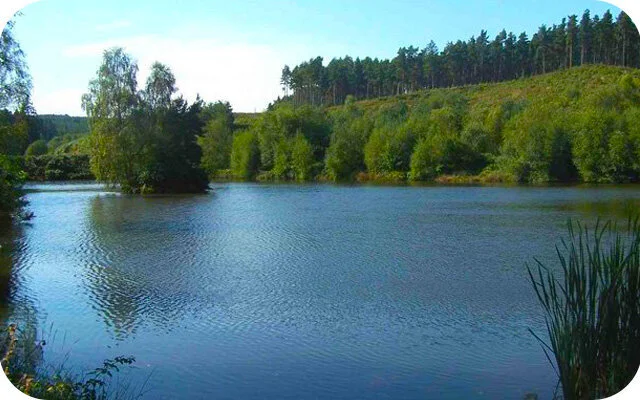
This third route heads off in the opposite direction to the second route and it takes you on an adventure to the South and along the Churnet Valley. Head anticlockwise around this route as this gets the main big and strenuous climb out of the way first as you climb up the steep and wooded Moss's Banks. After the climb, the route is then much easier going as you join the Oasal Dale track and stroll down past the pretty Mill's Pond (from the walk photo) to Lord's Bridge. You'll then meet up with the Churnet Valley cycleway for a sweeping walk back towards the village. When you get back to Oakamoor, there is then a short circular meander around the village itself where you can visit either of the nice pubs for refreshments.
Oakamoor
4 miles
This final route option is another strenuous adventure in this wonderful part of Staffordshire. Head clockwise on this one to walk along the river and then climb up into the woodland like the second route. It then takes you much further north than that one, with much more climbing, until you finally reach the Staffordshire Moorlands Walk trail. From there you'll enjoy some nice views before following the long Moorlands trail back towards Oakamoor, eventually tracking the Cotton Brook wooded valley as you come back into the village. You'll be glad to know that the last stretch is downhill most of the way as you work your way back to your reward in the village's lovely oubs, and includes one very steep decline so be careful there.
Osmaston
3.5 miles
This first route is a very pleasant walk that starts by the church in Osmaston, which is a small village just over the county border into Derbyshire. This walk will take you along pretty country lanes, through the Shirley Park woodland, past lakes and across the pretty countryside around Osmaston Park. There is also a nice pub for refreshments at the end of your walk.
Osmaston
4.75 miles
This is a slightly longer version of the Osmaston walk which heads in the same direction as the first walk, but doesn't take the path through the Shirley Park woodland. Instead you carry on through lovely countryside to the pretty village of Shirley where there is another wonderful village pub (half way around the walk.) After visiting the village, you then loop back along pretty country lanes, past lakes and woodland, across farmland and alongside Shirley Brook to Osmaston where there is another nice pub to enjoy.
Park Hall Country Park
0.75 miles
Park Hall Country Park is a fantastic place for a walking adventure where you can enjoy numerous different species of fauna and wildlife. This set of 'Park Hall Hill' Walks all start from one of three car parks in the park that we have featured on the app to help you navigate around this beautiful space. The first route from this car park is a nice and short stroll around the pools of Lady Corner which boasts some pretty woodland walking and a large variety of aquatic wildlife around the ponds.
Park Hall Country Park
1 mile
The second route option from this car park heads in the opposite direction to the first route and instead takes you on a nice short walking loop through more open landscapes that enjoy some pretty views from the Park Hall Hill.
Park Hall Hill
1.5 miles
This third route option is basically an extension to the second Park Hill route. As well as enjoying everything from the second route, it also takes you deeper into the park to enjoy the wonderful views from another hill called Ford Hill and also the wildflower meadows that are vibrantly colourful when they are in bloom.
Park Hall Hill
2.25 miles
The fourth option from this car park is basically a longer walk that combines the hills and views of the third route option, with the woodland, ponds and aquatic wildlife of the first route option. This creates a lovely varied walk full of wonder and adventure in the south western section of the Park.
Park Hall Hill
6.5 miles
This final route is an epic adventure around the entire Park Hall Country Park. You can do this walk from any of the three car parks that we have featured on the app and it basically takes you around all of the highlights of the park in one long and wonderful walk. This includes the dramatic Hulme Canyon, the wonderful pine forest of Pump Tree Wood, the pools at lady corner, the views from Park Hall Hill and the varied woodland strolling of Willot's Wood.
Perry Hall Park
1.25 miles
Perry Hall Park is a big open green space that used to be the ornamental gardens and parkland of an Elizabethan Mansion called Perry Hall. Nowadays, it's home to the Birmingham Cricket League so it's a vibrant recreational space. This first route is on solid paths throughout, so it's suitable for most wheels, and it tracks the River Tame for a while and visits an old moat for those in need of some waterside time. This walk is perhaps not as peaceful and beautiful as most of our rural countryside walks, but it's a great accessible alternative without getting out of the city.
Perry Hall Park
2 miles
This second route is simply a longer version of the walk around the Perry Hall Fields and alongside the River Tame. This route takes you off the solid path through onto grass for the extension, so it might not be as good for some wheels.
Pump Tree Woods
0.5 miles
Park Hall Country Park is a fantastic place for a walking adventure where you can enjoy numerous different species of fauna and wildlife. This set of 'Pump Tree Woods' Walks all start from one of three car parks in the park that we have featured on the app to help you navigate around this beautiful space. The first route is a nice and short walk around the Pine Tree woodlands of Pump Tree Wood that was planted in the 1960's to mask some of the quarrying activity that was done at the time.
Pump Tree Woods
1 mile
The second route option from the Pump Tree Woods car park is basically an extension of the first route that takes you deeper into the park and on a stroll around Skinners Canyon.
Pump Tree Woods
1.5 miles
This third option is a further extension of the Pump Tree Wood walk that still enjoys the pine tree woods and pond from the first two routes, but then also ventures deeper into the Park Hall Country Park and visits the impressive Hulme Quarry with it's dramatic landscapes.
Pump Tree Woods
6.5 miles
This final route is an epic adventure around the entire Park Hall Country Park. You can do this walk from any of the three car parks that we have featured on the app and it basically takes you around all of the highlights of the park in one long and wonderful walk. This includes the dramatic Hulme Canyon, the wonderful pine forest of Pump Tree Wood, the pools at lady corner, the views from Park Hall Hill and the varied woodland strolling of Willot's Wood.
Queens & Florence Park
1.25 miles
This short walk takes you around the lovely Queens Park in the Barlaston Parish of Stoke on Trent. It opened in 1888 and is typical in design of a late Victorian town park. There are tree lined pathways and fifteen thousand of these trees and shrubs were donated by the Duke of Sutherland. There is a pretty lake and a bandstand as well as a cafe in the middle of the park for refreshments.
Queens & Florence Park
2.5 miles
This second route heads off in the opposite direction from this start point and takes you on an adventure to the other park in the area, the Florence Country Park. You'll head through a couple of streets of a residential area to get there, but once you're in you can enjoy a vast open country park with wonderful views and some nice woodland to stroll through. The Queens park from the first walk option is full of amenities, but in contrast this second route is a bit more of a 'wild' park. There is also a fair bit of climbing involved as the route takes you down to the base of the park's hill and then climbs back up.
Queens & Florence Park
3.75 miles
This final route option is basically a figure of eight walk that incorporates both of the parks from the first two routes. You'll enjoy the amenities, landscaped gardens and lakes of the Queens Park, and then the open, fresh air and sweeping views of the Florence Country Park, all in one route.
Rudyard Lake
4.5 miles
A scenic walk around Rudyard Lake with plenty of things to do alongside a lovely walk.
Rugeley
3.75 miles
A nice circular walk starting near the Trent Valley Railway station in Rugeley, taking you across open fields and farmland, crossing Moreton Brook and passing through the village of Colton, joining the Staffordshire Way and following the Trent and Mersey Canal back to the start. Some lovely views and varied terrain, there is some road walking on lanes and on paths near busy roads during the course of the walk. This is the short version of the walk, the longer version takes you up to Stockwell Heath and is 3km longer.
Rugeley
6 miles
This second route is a longer circular walk starting near the Trent Valley Railway station in Rugeley and it takes you across open fields and farmland to Hurst Wood and then onto Stockwell Heath with its pretty duck pond. On the way back you will pass through the village of Colton, joining the Staffordshire Way and following the Trent and Mersey Canal back to the start. Some lovely views and varied terrain, there is some road walking on lanes and on paths near busy roads during the course of the walk.
Sandon Park
4.25 miles
This is an 'off-the-beaten track' peaceful countryside walk around the pretty Sandon Park and it's surrounding countryside. Heading anticlockwise, you'll stroll through the open fields of the park itself, passing the Sandon Park Folly Tower on your left as you go. You'll then stroll through more open countryside until you touch into the village of Gayton where you'll meander through the grounds of a nice church. After that there is a section of road walking along a quiet country lane before you cut back into some countryside to start the return journey to the start point, passing through the nice woodlands of Sandon Woods on the way.
Silverdale Country Park, Staffordshire
Stafford
1.25 miles
This first route is a nice and simple stroll around the pretty market town of Stafford. You'll stroll alongside the River Sow, wander through the town centre itself with it's shops and eateries, meander through the Victoria Park with it's memorial, visit the impressive Church of St Mary and even pass a cool play area for the little ones.
Stafford
2.5 miles
The second walk option from Stafford doesn't take you into the town, but instead it heads outand along the 'Isabel Trail' deep into the Doxey Marshes. This is a perfect place to stroll and enjoy nature and there are lots of Bird species to spot on your walk. There is a significant section of 'there and back' walking on this route with a loop around the marshes at the end and you can of course combine this with the first route to make a nice long day out.
The Cloud
2.5 miles
This walk is slightly over the county border into Cheshire, but it's worth it for this short but strenuous adventure where you'll feel on top of the world. Although it's a relatively short walk, be prepared for an energetic hike to the top of The Cloud where you will be rewarded with spectacular views across the surrounding Staffordshire and Cheshire countryside.
The Cloud
3.75 miles
The first walk to the Cloud is obviously the glory walk from this starting point, but if you want a lighter alternative with less climbing, then this second route is a lovely walking loop in the pretty countryside between Congleton and Timbersbrook. The walk mainly takes you through peaceful open farmland but about half way around the walk you get a stretch of canal-side walking alongside the Macclesfield Canal and also an additional loop that ventures into the pretty Dane in Shaw Pastures.
The Cloud
5.5 miles
This third route is a wonderful walk that basically combines the first two walks together to create a long and varied adventure in this lovely area. You'll enjoy the climbing and epic views from the cloud, the woodland paths at the base of the Cloud hill, the canal-side meander along the Macclesfield Canal, the tranquil beauty of the Dane-in-Shaw pasture and of course all the peaceful countryside in between.
The Cloud
9 miles
This final route option is the ultimate adventure in this lovely area just over the county border into Cheshire. There are a lot of hills to tackle on this route, so you'll need to go prepared with energy and refreshments, but it's worth it for the lovely varied walk. You'll enjoy majestic views from the various hills on the walk, a long sweeping walk along the pretty Macclesfield Canal, a stroll around the Dane in Shaw pasture and lots of peaceful open countryside. It's a long walk so please ensure you have a full battery and alternative navigation before you head off. Only use the app when you need to for navigation as well as this will use less phone battery. Finally, please be aware that there is a section of walking on a road half way around this route, so please be careful here.
Walsall Arboretum
1 mile
The Walsall Arboretum is a pretty Victorian park on the edge of the town of Walsall and this first route is a short family-friendly excursion into the park. If you head clockwise, the route takes you through the park until you get to the extensive children's play area and splash park, before looping back along a tree-lined path alongside a winding brook.
Walsall Arboretum
2.25 miles
The second route is basically a longer extension of the first route that enjoys the Arboretum park in full. It takes you through the park and past the children's play area like in the first route, but then it also takes you further into the park to visit the nice cafe and walk around the pretty Hatherton Lake.
Waterhouses
4.25 miles
This is a nice stroll in the pretty countryside surrounding the village of Waterhouses. If you head clockwise, you'll venture off through open countryside until you reach the village of Waterfall where you will find a lovely little pub about half way around the route. After this, you'll head out through pretty open countryside again, tracking a brook, until you reach the Manifold Way that will then take you all the way back to the start point.
Weag's Bridge
1.75 miles
Our first route option is our shortest walk from the Weag's Bridge car park and it takes you along a short section of the Manifold track and loops back up and through lovely countryside back to the start. The Manifold Track is popular with walkers, cyclists and horse riders and follows the old disused Leek and Manifold Light Railway and parts of the River Manifold and River Hamps.
Weag's Bridge
3 miles
This second option is a lovely circular walk that includes a longer section of the Manifold track and follows the route of the River Manifold as well as taking you across fields, open countryside and through the village of Grindon. We have also added a detour to the route which will take you to Thor's Cave which is a natural cavern located in a steep limestone crag. There are some hill climbs on this route.
Weag's Bridge
4.5 miles
This is our third walk from Weag's Bridge and it follows a wonderful stretch of the Manifold track, which snakes through the Manifold and Hamps Valleys. As you reach the end of the Manifold track section of this route, there is a delightful tea room but please check that it's open beforehand. The walk then takes you back through fields, quiet lanes/tracks and open countryside. There are some hill climbs on this route.
Weag's Bridge
6.5 miles
Our final walk from Weag's Bridge is another wonderful but strenuous adventure in this lovely area. If you head anticlockwise on this route it takes up all the way south along the wonderful Manifold track until you nearly reach the village of Calton before then looping back through glorious undulating countryside, visiting the ruins of Throwley Old Hall on the way. There are a lot of hills on the route, so please go prepared with appropriate footwear and refreshments.
Westport Lake
1.25 miles
This is a lovely short walk around Westport Lake on a level footpath. The walk takes you around the large lake where you can watch the various waterfowl and on a nice stroll through the woodland. There is a cafe with a lovely waterside terrace if you want to stop for refreshments.
Wetton Mill
2.5 miles
This first route option from Wetton Mill is a short walk around the lovely hilly landscapes to the north of Wetton. This one mainly walks around the outside of the hills and through the valleys rather than right over the top of them, so it's not as strenuous as the other options. That said, it's still a hilly area, so some energy will be required for this walk. There is a nice cafe at the start of the walk and a little detour to visit the Nan Tor cave.
Wetton Mill
4 miles
This second route is a long, varied and somewhat more strenuous walk that fully explores the wonderful landscapes around Wetton Hill. If you head clockwise, this route walks out into the open valley and around the base of Wetton Hill until it takes you into the pretty village of Wetton where you'll find a wonderful pub for refreshments. After that, you'll head out of the village and follow the pretty Thor's Lane on an adventure to the dramatic Thor's Cave. Please be careful around here as there are some dangerous drops to be aware of. Finally, the walk then takes you back to the start via the Manifold Track and there is a welcoming cafe there for any post walk refreshments.
Wetton Mill
4.75 miles
This final route option is basically a turbo-charged version of the second route. It still enjoys the Manifold Track, Thor's Cave, the pub in Wetton and lots of generally wonderful scenery, but instead of walking around the base of Wetton Hill, it climbs right over the top of it. This climb is very steep, so please be careful and make sure you have the correct clothing for the trip. It truly is a strenuous adventure, but you will of course be rewarded with some magnificent panoramic views for your efforts.
Wheaton Aston
2.5 miles
This nice short family-friendly walk starts in the village of Wheaton Aston and takes you across open farmland and on a stroll along the banks of the pretty Shropshire Union Canal. There is a pub by the canal for refreshments and there is some road walking through the village, so please be careful here.
Wheaton Aston
6.25 miles
This second route option is the choice for you if you have more time to stretch your legs and you want to build up a bigger appetite for your reward at the canal-side pub after your walk. If you head anticlockwise you'll walk through open farmland until you finally reach the lovely Belvide Reservoir. You'll then walk around the reservoir and then join a quiet country lane that takes you to meet the Shropshire Union Canal. From there, it's a long sweeping canal-side walk all the way back to the village and lovely waterside pub. As mentioned above, there is a section of walking along a quiet lane on this route and there is also two busy road crossings to tackle, so please be careful at these points.
Whitfield Valley, Staffordshire
Willots Wood
1.25 miles
Park Hall Country Park is a fantastic place for a walking adventure where you can enjoy numerous different species of fauna and wildlife. This set of 'Willot's Wood' Walks all start from one of three car parks in the park that we have featured on the app to help you navigate around this beautiful space. The first route from this car park is a lovely circular walk around Willot's Wood which is a deciduous woodland containing a wide variety of native British trees. You can expect to see Common Oak, Silver Birch, Hazel, Hawthorn, Rowan, Holly and a vast carpet of Bluebells in the spring.
Willots Wood
2.5 miles
This second route option from this car park is a longer adventure that packs two delightful punches. If you head anticlockwise, you'll first enjoy the wonderful varied woodland of Willot's Wood as in the first route. However, the second half of the walk then takes you on an adventure deeper into the park until you reach the Hulme Canyon for a stroll full of dramatic scenery.
Willots Wood
6.5 miles
This final route is an epic adventure around the entire Park Hall Country Park. You can do this walk from any of the three car parks that we have featured on the app and it basically takes you around all of the highlights of the park in one long and wonderful walk. This includes the dramatic Hulme Canyon, the wonderful pine forest of Pump Tree Wood, the pools at lady corner, the views from Park Hall Hill and the varied woodland strolling of Willot's Wood.
Wombourne
2.25 miles
This first walk is a short walk from the Bratch Picnic site. Head clockwise on this route to get the short section of road walking out of the way first before turning onto the pretty Staffordshire Railway Path at the Cafe. After a nice stretch of walking along the railway path, you'll reach a turning in the path that takes you alongside the Wom Brook for a while before emerging onto the Staffordshire and Worcestershire Canal. The final stretch is then a pleasant stroll alongside the canal which has an optional little detour taking you to a nice waterside pub for refreshments. If you don't need the pub stop, just ignore the detour and follow the canal all the way back up to the start point.
Wombourne
2.25 miles
This second option is another short walk from Bratch Locks that heads in the opposite direction to the first route. If you head clockwise, it follows the Staffordshire and Worcestershire canal again, but this time with with more open fields and woodland on either side. The walk then takes you to Awbridge Bridge, where there is some quiet road walking surrounded by open countryside until you reach the railway bridge on Flash Lane which takes you onto the scenic South Staffs railway walk. This old railway path will then take you on a peaceful stroll all the way back to Bratch Lane (a road without paths) near the start. It's not an actual pub on the route as such, but there is a lovely licensed cafe for refreshments towards the end of the route.
Wombourne
4 miles
The third route is basically an extension of the second walk option and it follows the Staffordshire and Worcestershire canal for a longer stretch with open fields and woodland on either side. If you head clockwise, the walk takes you on a lovely canal-side stroll past Penn substation and then crosses over the River Stour bringing you out onto a road near Lower Penn. There are no footpaths on this short section of road as you pass over the bridge or on the lane further up, so please be careful. You will then join the Staffordshire Railway Path that will take you on a scenic walk all the way back to Bratch Lane at the start. It's not an actual pub on this route as such, but there is a lovely licensed cafe for refreshments towards the end of the route.
Wombourne
5.5 miles
This final route is basically one walk that combines all of the options above to create an epic canal-side and railway walk adventure. One half of the walk is a majestic long stroll alongside the canalside itself, with a pitstop detour to a lovely pub, and the other half of the walk is a meander along the tree-lined Staffordshire Railway Path. Head clockwise around the route if you want the pub to be towards the end of the walk.
Map image credit:
© OpenStreetMap contributors
Contains OS data © Crown copyright and database right 2021